Project to georeference Anaya Springs arroyos
-
OSGEO GDAL and OGR: Raster and Vector Geospatial functions
- Apt/RPM package must be installed on the base system, and python package must be installed in the default system python, then the virtual environment must inherit
-
ExifRead: reads image metadata
-
Pillow: Image processing, https://pillow.readthedocs.io/en/latest/handbook/index.html
- dam images, organized by arroyo
- directories named like xx_name, where xx is a number, and name is the
arroyo name - files named like name_yyyy-mm-dd_xxx where name is some variation of the arroyo name, and yyyy-mm-dd is the date, and xxx is the image number
- again, standardized names
- found repeated images
- added new_dams, standardizing names, to the dams directory
- re-ran the program
-
Track files that share a similar location, within a buffer distance of an existing known location for that dam (found from an image where Bill corrected the gps coordinates for that image)
-
Ensure we both have same data
- Copy all of dam images from 2023 corrections that Bill requested and Aimee made on the full dataset. Corrections include corrected coordinates, moved and renamed dams, and deleted images. Copy this entire "clean" dataset to Bill's computer, name it dams_2023 on both Bill and Aimee's computers. (done 2025-08-22).
- For Bill's new 2025 images, manually edit directory/arroyo names to match pattern established in the clean dataset. (done 2025-08-22)
- Copy these images as 2025_survey to both computers. (done 2025-08-22).
- Aimee extend the name-standardization program to rename the dam images within these 2025_survey directory using the image metadata. (done 2025-08-23)
- Aimee move pre-2023 66_HighHopes tif images from 2025_survey to dams_2023 directory, on both computers (done 2025-08-23)
- Aimee corrected some names in dams_2023 for dam number, name consistency (to match 2025) renamed to dams_2023_b (?)
-
Group 2025_survey images by dam_x (add subdir). All images are 2025 data and every image represents a separate dam. These probably have the most accurate GPS coordinates, so we will consider them "truth". Output is dams_2025_damsep
-
Group dams_2023 (clean) dam images by dam within an arroyo (match on exact gps point)
-
Examine grouped dams_2023 images by dam, determine if they belong with an existing dam in the dams_2025 data, or if they are unique (possibly areas that can no longer be surveyed, or just missed). Log questionable points for review by Bill
- Populate metadata
- Read all the existing data for an arroyo, group images by matching gps coordinates
- Add a dam_x name to each dam in image dictionary
- Rewrite original data, creating a subdirectory for each dam_x dam, with multiple images from different years --> dams_2025
-
Read new 2025 images and writes to dams_2025 input
-
Read old images into dictionary
-
For each new 2025 images
- Search for old arroyo in dictionary, find closest established dam
- Write dam_x to dictionary
- Write gps coordinates to image file
- Write image file to dam_x directory
-
transform.dam_map.PicMapper contains all the functions to read metadata, and read and rewrite image files.
common.util contains helper functions for image processing main.py is the script to execute image file assessment and rewrite
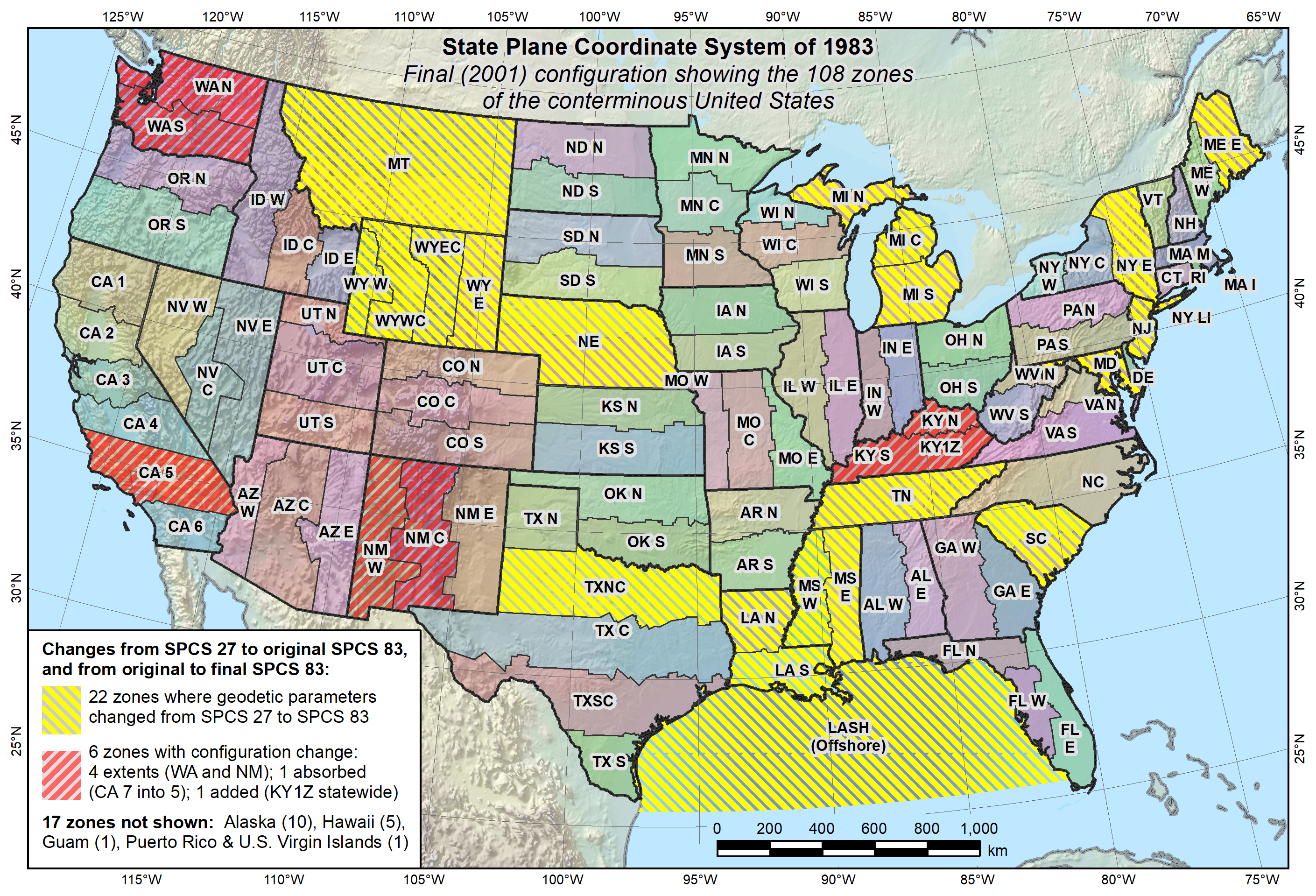
- Data is in ESPG:102713, aka ESRI:102713
- NAD 1983 StatePlane New Mexico Central FIPS 3002 Feet
- State Plane map at https://geodesy.noaa.gov/SPCS/images/spcs83_conus_final.png
- Projection defined at https://epsg.io/102713
- Data provided by the county
- 140814 refers to a geospatial grid defined by state
- All data in EPSG:102713
- DEM - 2800x2805, print at 150 dpi~= 18.6"
astewart@badenov:/tank/anaya/ancillary$ gdalinfo dem140814.tif
Driver: GTiff/GeoTIFF
Files: dem140814.tif
       dem140814.tif.aux.xml
Size is 2800, 2805
Coordinate System is:
PROJCRS["NAD83(HARN) / New Mexico Central (ftUS)",
    BASEGEOGCRS["NAD83(HARN)",
        DATUM["NAD83 (High Accuracy Reference Network)",
            ELLIPSOID["GRS 1980",6378137,298.257222100887,
                LENGTHUNIT["metre",1]]],
        PRIMEM["Greenwich",0,
            ANGLEUNIT["degree",0.0174532925199433]],
        ID["EPSG",4152]],
    CONVERSION["Transverse Mercator",
        METHOD["Transverse Mercator",
            ID["EPSG",9807]],
        PARAMETER["Latitude of natural origin",31,
            ANGLEUNIT["degree",0.0174532925199433],
            ID["EPSG",8801]],
        PARAMETER["Longitude of natural origin",-106.25,
            ANGLEUNIT["degree",0.0174532925199433],
            ID["EPSG",8802]],
        PARAMETER["Scale factor at natural origin",0.9999,
            SCALEUNIT["unity",1],
            ID["EPSG",8805]],
        PARAMETER["False easting",500000.000000001,
            LENGTHUNIT["metre",1],
            ID["EPSG",8806]],
        PARAMETER["False northing",0,
            LENGTHUNIT["metre",1],
            ID["EPSG",8807]]],
    CS[Cartesian,2],
        AXIS["easting",east,
            ORDER[1],
            LENGTHUNIT["US survey foot",0.304800609601219]],
        AXIS["northing",north,
            ORDER[2],
            LENGTHUNIT["US survey foot",0.304800609601219]],
    ID["EPSG",2903]]
Data axis to CRS axis mapping: 1,2
Origin = (1693300.000000000000000,1619230.000000000000000)
Pixel Size = (2.000000000000000,-2.000000000000000)
Metadata:
  AREA_OR_POINT=Area
Image Structure Metadata:
  INTERLEAVE=BAND
Corner Coordinates:
Upper Left  ( 1693300.000, 1619230.000) (106d 4'20.76"W, 35d27' 1.09"N)
Lower Left  ( 1693300.000, 1613620.000) (106d 4'20.88"W, 35d26' 5.60"N)
Upper Right ( 1698900.000, 1619230.000) (106d 3'13.07"W, 35d27' 0.98"N)
Lower Right ( 1698900.000, 1613620.000) (106d 3'13.20"W, 35d26' 5.49"N)
Center      ( 1696100.000, 1616425.000) (106d 3'46.98"W, 35d26'33.29"N)
Band 1 Block=2800x128 Type=Float32, ColorInterp=Gray
  Description = Surface Model Raster Band
  Min=5837.841 Max=6139.475
  Minimum=5837.841, Maximum=6139.475, Mean=5995.771, StdDev=66.157
  NoData Value=-32767
  Metadata:
    STATISTICS_MAXIMUM=6139.4750976562
    STATISTICS_MEAN=5995.7708782904
    STATISTICS_MINIMUM=5837.8413085938
    STATISTICS_STDDEV=66.156804511765
- Input raster data from county, op140814.tif
- All additional files are duplicates, with TIFFTAG_DATETIME=2015:05:03 21:46:49
- 11201 pixels square - to print at 150 dpi --> 74" square
$ gdalinfo op140814.tif
Driver: GTiff/GeoTIFF
Files: op140814.tif
Size is 11201, 11221
Origin = (1693299.500000000000000,1619230.500000000000000)
Pixel Size = (0.500000000000000,-0.500000000000000)
Metadata:
  TIFFTAG_DATETIME=2015:05:03 21:46:49
  TIFFTAG_IMAGEDESCRIPTION=OrthoVista
  TIFFTAG_RESOLUTIONUNIT=2 (pixels/inch)
  TIFFTAG_SOFTWARE=Adobe Photoshop CS6 (Windows)
  TIFFTAG_XRESOLUTION=72
  TIFFTAG_YRESOLUTION=72
Image Structure Metadata:
  COMPRESSION=JPEG
  INTERLEAVE=PIXEL
Corner Coordinates:
Upper Left  ( 1693299.500, 1619230.500)
Lower Left  ( 1693299.500, 1613620.000)
Upper Right ( 1698900.000, 1619230.500)
Lower Right ( 1698900.000, 1613620.000)
Center      ( 1696099.750, 1616425.250)
Band 1 Block=256x256 Type=Byte, ColorInterp=Red
  Overviews: 5601x5611, 2801x2806, 1401x1403, 701x702, 351x351, 176x176, 88x88, 44x44, 22x22, 11x11
Band 2 Block=256x256 Type=Byte, ColorInterp=Green
  Overviews: 5601x5611, 2801x2806, 1401x1403, 701x702, 351x351, 176x176, 88x88, 44x44, 22x22, 11x11
Band 3 Block=256x256 Type=Byte, ColorInterp=Blue
  Overviews: 5601x5611, 2801x2806, 1401x1403, 701x702, 351x351, 176x176, 88x88, 44x44, 22x22, 11x11
Band 4 Block=256x256 Type=Byte, ColorInterp=Undefined
  Overviews: 5601x5611, 2801x2806, 1401x1403, 701x702, 351x351, 176x176, 88x88, 44x44, 22x22, 11x11
- Input shapefile data, flowline_140814.shp
- ogrinfo
- projection parameters match
- datum mismatch
$ ogrinfo -al flowline_140814.shp | more
INFO: Open of `flowline_140814.shp'
      using driver `ESRI Shapefile' successful.

Layer name: flowline_140814
Metadata:
  DBF_DATE_LAST_UPDATE=2015-11-24
Geometry: Line String
Feature Count: 3858
Extent: (1693145.000052, 1613437.000092) - (1699098.999955, 1619302.999843)
Layer SRS WKT:
PROJCRS["NAD83(HARN) / New Mexico Central (ftUS)",
    BASEGEOGCRS["NAD83(HARN)",
        DATUM["NAD83 (High Accuracy Reference Network)",
            ELLIPSOID["GRS 1980",6378137,298.257222101,
                LENGTHUNIT["metre",1]],
            ID["EPSG",6152]],
        PRIMEM["Greenwich",0,
            ANGLEUNIT["Degree",0.0174532925199433]]],
    CONVERSION["unnamed",
        METHOD["Transverse Mercator",
            ID["EPSG",9807]],
        PARAMETER["Latitude of natural origin",31,
            ANGLEUNIT["Degree",0.0174532925199433],
            ID["EPSG",8801]],
        PARAMETER["Longitude of natural origin",-106.25,
            ANGLEUNIT["Degree",0.0174532925199433],
            ID["EPSG",8802]],
        PARAMETER["Scale factor at natural origin",0.9999,
            SCALEUNIT["unity",1],
            ID["EPSG",8805]],
        PARAMETER["False easting",1640416.66666667,
            LENGTHUNIT["US survey foot",0.304800609601219],
            ID["EPSG",8806]],
        PARAMETER["False northing",0,
            LENGTHUNIT["US survey foot",0.304800609601219],
            ID["EPSG",8807]]],
    CS[Cartesian,2],
        AXIS["(E)",east,
            ORDER[1],
            LENGTHUNIT["US survey foot",0.304800609601219,
                ID["EPSG",9003]]],
        AXIS["(N)",north,
            ORDER[2],
            LENGTHUNIT["US survey foot",0.304800609601219,
                ID["EPSG",9003]]]]
- Input shapefile data, topo_140814.shp
- ogrinfo
- projection parameters match
- datum mismatch
$ ogrinfo -al topo_140814.shp | more
INFO: Open of `topo_140814.shp'
      using driver `ESRI Shapefile' successful.

Layer name: topo_140814
Metadata:
  DBF_DATE_LAST_UPDATE=2015-11-24
Geometry: Line String
Feature Count: 8859
Extent: (1693301.000000, 1613621.000000) - (1698899.000000, 1619229.000000)
Layer SRS WKT:
PROJCRS["NAD83(HARN) / New Mexico Central (ftUS)",
    BASEGEOGCRS["NAD83(HARN)",
        DATUM["NAD83 (High Accuracy Reference Network)",
            ELLIPSOID["GRS 1980",6378137,298.257222101,
                LENGTHUNIT["metre",1]],
            ID["EPSG",6152]],
        PRIMEM["Greenwich",0,
            ANGLEUNIT["Degree",0.0174532925199433]]],
    CONVERSION["unnamed",
        METHOD["Transverse Mercator",
            ID["EPSG",9807]],
        PARAMETER["Latitude of natural origin",31,
            ANGLEUNIT["Degree",0.0174532925199433],
            ID["EPSG",8801]],
        PARAMETER["Longitude of natural origin",-106.25,
            ANGLEUNIT["Degree",0.0174532925199433],
            ID["EPSG",8802]],
        PARAMETER["Scale factor at natural origin",0.9999,
            SCALEUNIT["unity",1],
            ID["EPSG",8805]],
        PARAMETER["False easting",1640416.66666667,
            LENGTHUNIT["US survey foot",0.304800609601219],
            ID["EPSG",8806]],
        PARAMETER["False northing",0,
            LENGTHUNIT["US survey foot",0.304800609601219],
            ID["EPSG",8807]]],
    CS[Cartesian,2],
        AXIS["(E)",east,
            ORDER[1],
            LENGTHUNIT["US survey foot",0.304800609601219,
                ID["EPSG",9003]]],
        AXIS["(N)",north,
            ORDER[2],
            LENGTHUNIT["US survey foot",0.304800609601219,
                ID["EPSG",9003]]]]
Data axis to CRS axis mapping: 1,2
- Input raster dem140814.tif
- gdalinfo
- indicates SRS EPSG:2903, https://epsg.io/2903
- parameters do not match
- layer overlays with others in QGIS
$ gdalinfo dem140814.tif
Driver: GTiff/GeoTIFF
Files: dem140814.tif
       dem140814.tif.aux.xml
Size is 2800, 2805
Coordinate System is:
PROJCRS["NAD83(HARN) / New Mexico Central (ftUS)",
    BASEGEOGCRS["NAD83(HARN)",
        DATUM["NAD83 (High Accuracy Reference Network)",
            ELLIPSOID["GRS 1980",6378137,298.257222100887,
                LENGTHUNIT["metre",1]]],
        PRIMEM["Greenwich",0,
            ANGLEUNIT["degree",0.0174532925199433]],
        ID["EPSG",4152]],
    CONVERSION["Transverse Mercator",
        METHOD["Transverse Mercator",
            ID["EPSG",9807]],
        PARAMETER["Latitude of natural origin",31,
            ANGLEUNIT["degree",0.0174532925199433],
            ID["EPSG",8801]],
        PARAMETER["Longitude of natural origin",-106.25,
            ANGLEUNIT["degree",0.0174532925199433],
            ID["EPSG",8802]],
        PARAMETER["Scale factor at natural origin",0.9999,
            SCALEUNIT["unity",1],
            ID["EPSG",8805]],
        PARAMETER["False easting",500000.000000001,
            LENGTHUNIT["metre",1],
            ID["EPSG",8806]],
        PARAMETER["False northing",0,
            LENGTHUNIT["metre",1],
            ID["EPSG",8807]]],
    CS[Cartesian,2],
        AXIS["easting",east,
            ORDER[1],
            LENGTHUNIT["US survey foot",0.304800609601219]],
        AXIS["northing",north,
            ORDER[2],
            LENGTHUNIT["US survey foot",0.304800609601219]],
    ID["EPSG",2903]]
Data axis to CRS axis mapping: 1,2